A massive construction project to make the Arkansas River more navigable for heavier barge traffic is finally underway after two decades in the making.
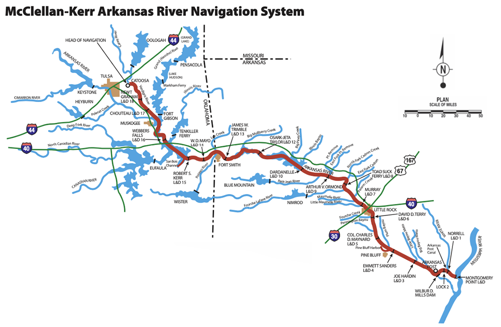
The U.S. Army Corps of Engineers, in the Little Rock and Tulsa districts, is beginning the planning and design work to deepen the shipping channel to 12 feet on the 445-mile McClellan-Kerr Arkansas River Navigation System (MKARNS). The system runs from the Tulsa Port of Catoosa southeast through Arkansas to the Mississippi River near Helena.
The MKARNS 12-foot Channel Deepening Project first gained federal approval in 2004 but no funding was appropriated for it. That changed with the Infrastructure Investment & Jobs Act (IIJA), which was passed in late 2021.
The Corps of Engineers received slightly more than $92 million for the project in March. That sum will be enough for the Corps to do all the research and design for the project and get the construction started; more funding will be required to complete the endeavor.
The Corps said the design phase of the project is projected to last into 2025. Construction over the length of the Navigation System could last another decade.
“This is already about a 20-year-old project, and we still need some time to get it done,” said Jay Townsend, chief of public affairs for the Corps’ Little Rock District.
Part of the planning and design will be to generate some estimates for how much the construction portion will cost. A decade ago, the Corps estimated that the project could cost nearly $200 million; it is doubtful that it could be done at such a bargain rate now.
“It just takes a long time to get it funded,” said Bryan Day, the executive director of the Little Rock Port Authority. “We believe that now it is in the Corps of Engineers budget as an active project, that the money will come over the next three to five years.
“It is a large project, and it won’t happen overnight. It is an active and real project now.”
3-Foot Difference
The benefits of deepening the Arkansas River Navigation System from 9 feet to 12 feet are obvious from the economics of transportation point of view. A single barge can carry 1,500 tons of gravel, for example, with a draft of 9 feet. The additional draft allowance of a 12-foot channel would let the barge carry 33% more cargo, according to the Corps.
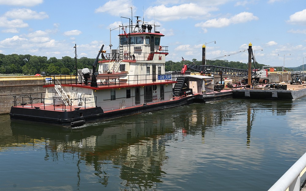
Barge traffic on the river features multiple barges being pushed by a tugboat. A 15-barge tow could transport close to 30,000 tons more per trip on a deepened river; it would take more than 1,000 tractor-trailers on the highways to carry similar weight.
“The heavier you can load a barge the more competitive it is,” Day said. “When you are bidding on jobs to move barge loads of something like rock or sand, and you can only load to 9 feet when a barge on the Mississippi or the Ohio or Tennessee rivers can load to 12 feet, it is very uncompetitive.
“We are not only competing against the world, we are competing against other states. If other states have a river that can draft to 12 feet and the Arkansas River only drafts to 9 feet, we can’t compete. It will allow us to be on an equal playing field with other rivers.”
More than $5 billion worth of goods is transported on the Arkansas River Navigation System annually. More than 11 million tons of goods use the system, which the Corps upgraded from a moderate-use to a high-use system in 2015.
Perhaps the biggest benefactor of the 12-foot channel would be the Tulsa Port of Catoosa. The port is convenient for the shipping of many agricultural products from the Midwest and northern Plains, and a deeper channel means more cargo outbound and inbound.
“[It would be] the biggest boon for us,” said David Yarbrough, the executive director of the Tulsa Port of Catoosa. “In Oklahoma and certainly in our port, ag is king. For us, the ability to load 30% more in a barge — either winter wheat or soybeans or our liquid fertilized products that are made here — would be very, very beneficial.”
Training the River
The McClellan-Kerr Arkansas River Navigation System went into use in 1971 and consists of several waterways and rivers in addition to the Arkansas River. The Oklahoma portion is the Verdigris River, which feeds 50 miles later into the Arkansas; in eastern Arkansas, the Arkansas funnels into the Arkansas Post Canal for 9 miles and then into the White River for 10 before joining the mighty Mississippi.
For most of its journey through Arkansas, the Navigation System has a 12-foot channel depth. About 10% of the channel’s 308 miles in the state are 9 feet or inconsistently between 9 and 12 feet.
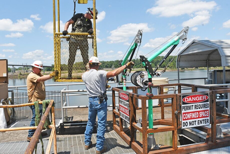
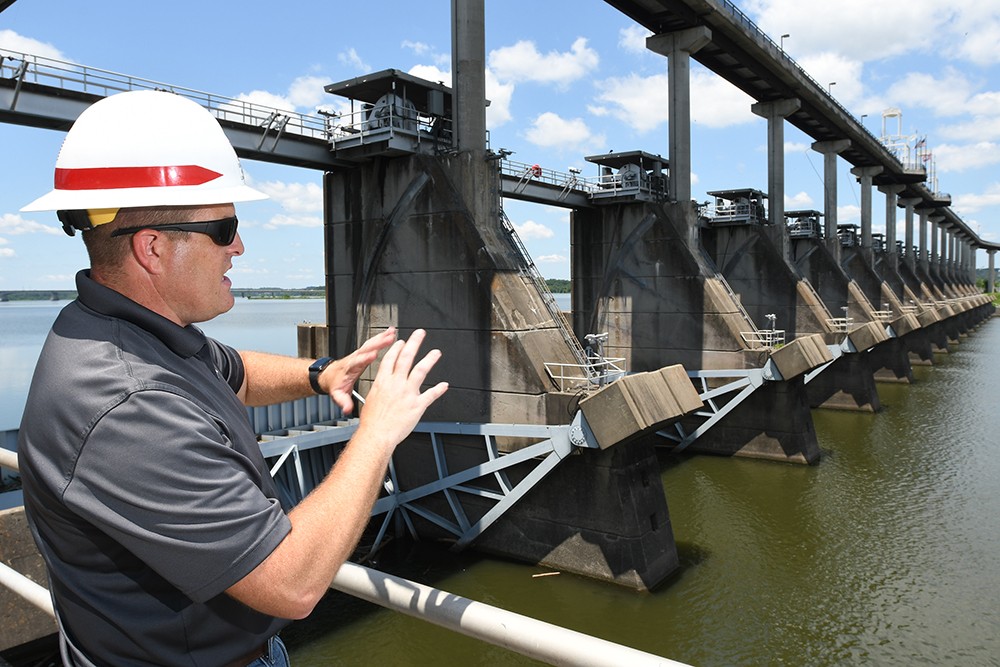
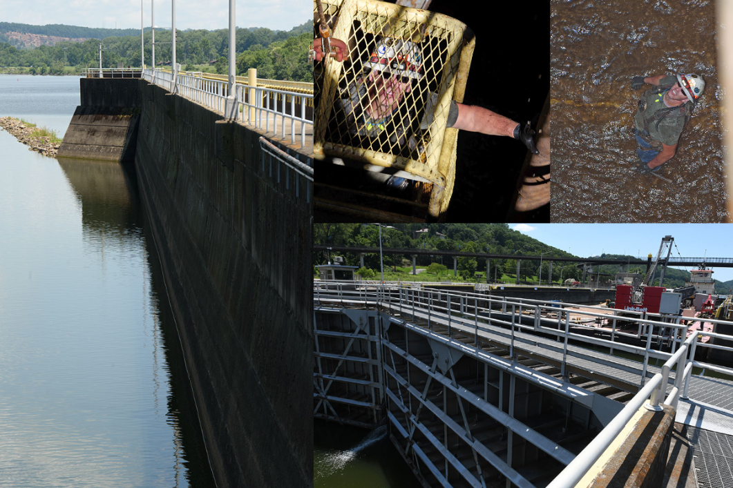
The system operates through the use of 18 locks and dams and several reservoirs over the 445 miles and 420 feet in elevation change from Tulsa to the Mississippi River.
“Oklahoma has a lot of limestone in our region, so it’s not just dredging,” Yarbrough said. “Some portions will have to be hard-rock excavation, blasting or other means besides dredging dirt or silt out of a channel.”
There are already many training structures on the river where the Corps placed jetties or revetments that funnel the flow of the river into the channel. This training allows the river’s current to scour the navigation channel deeper.
“We have training structures all the way up and down the Arkansas River system that are ensuring the current 9-foot depth; most will have to be adjusted,” Townsend said. “What we have to do is new construction on those training structures to make them bigger and make them longer and then respond to what they do.
“We are going to get some flows going down the river and we’re going to watch where they are pushing water. If it is where we want it then we’re done. If it’s not, we are going to get back out and do some new construction on those structures.”
Using the Asset
Cassandra Caldwell, the director of the Arkansas Waterways Commission, said the Arkansas River Navigation System is a tax source and that would only improve with more and heavier traffic.
“We would be able to move a lot more commodities; MKARNS right now provides about $280 million in state and local tax revenue,” Caldwell said. “With global trade predicted to increase, it is a critical resource. It is free transportation.
“It is underutilized, and part of the reason is we don’t have the 12-foot channel.”
Every barge on the river could mean fewer trucks on the roads. “America’s inland river system is not at capacity, so by creating a deeper channel, it allows us to take some of the pressure off roads and railways,” Day said. “By doing this, it creates more opportunity, better opportunity, a more efficient opportunity.”